Description of the study area
The field survey was conducted at seven locations, i.e., Bezawit, Debanke, Diaspora, Dudu, Gaja Mesk, Gordema and Sebatamit) (Figure 5). At each location, three habitats were selected for the study, i.e., protected, grassland, cultivated. Protected vegetation is a forest where grazing and felling of trees are prohibited, the grassland is free grazing area dominated by grasses and cultivated land is the area where crops are grown. This area is characterized as middle montane ecozone or tepid to cool sub-moist mid highlands. Bahir Dar is located at 11°36′N 37°23′E at an elevation of about 1,800 m above sea level.
Rainfall pattern in the study area. In this study area, the wet season runs from June to September and the dry season from October to May. Amhara State, situated in north eastern to northwestern Ethiopia, is one of the nine states in Ethiopia. The State is divided into wet western Amhara and semi-arid eastern Amhara. In terms of climate and vegetation, Bahir Dar area is typical of western Amhara. This region is relatively more temperate and wetter than eastern Amhara. The region is characterized by a monomodal rainfall pattern of the long rains during the summer season. The main rainy season aka the summer season runs from June to September. The mean rainfall duration of Bahir Dar area is 149 days [14]. The annual total rainfall of western Amhara, where the study site is situated, varies temporally and spatially, ranging from 878 mm to 2100 mm, with an average of 1370 mm per year (1979-2011). The summer season lasts for about three and a half months as a result of convergence in low-pressure systems, and the Inter Tropical Convergence Zone (ITCZ). This season contributes 77% (1054 mm) of the mean annual rainfall of western Amhara [15]. In Bahir Dar, summer season rains contribute 85% of the annual total [14]. The small rains, on the other hand, run from March to May; it does not significantly contribute to the annual total precipitation. The remaining months, i.e., October, November, December, January and February are considered dry season. The small rains and the dry season contribute less than 15% of the annual total rainfall. Between 1978 and 2008, in Bahir Dar, an annual mean rainfall of 1353 mm, a summer mean of 1147 mm, a small rains mean of 105 mm and a dry season mean of 101 mm were recorded [14].
Temperature. Between 1978 and 2008, the mean annual temperature of western Amhara was between 17oC and 26oC [14]. In Bahir Dar, for the same period, average minimum temperature was 11.5oC and the maximum was 26.9oC. The maximum temperature reaches its highest peak during March, April and May and declines in July, August and September. Annual averages between 1979 and 2008 showed increasing trend.
Characterization of the catchment area of Bahir Dar area and/or Lake Tana area
The classification of the landscape is done in accordance with the Agroecological Belts of Ethiopia [17]. A chain of mountains and an extensive upland plateau better known as Mount Guna, 3700 m above sea level, is found at aerial distance of 74 km northeast of the study area. Mount Guna belongs to the so-called Afro Alpine zone. Tussoc grass dominates the plateau. Next is the Subalpine Zone situated between 3200-3700 m altitudes. The natural vegetation there consists of Erica arborea and Hypericum revolutum. The Upper Montane Zone is situated at an altitude of 2300 – 3200 m consisting primarily of Hagenia woodland, with a tree height of less than 15 m.
The Middle Montane, representing the current study area, Bahir Dar, lies between 1500 and 2300 m altitude. This zone enjoys the most pleasant weather and it is preferred settlement area of the Amhara people of Ethiopia (pers. obs.). Its optimal temperate and humid climate is the most suitable for agriculture. Within this zone natural forests are still found in lower slopes, for example the Alem Saga State Forest and Tara Gedam forest. Tree species like Acacia abyssinica, Cordia africana, Celtis africana, Ficus sycomorus, Ficus vasta, Olea capensis hochstetteri and Cussonia holstii occur naturally within these forests. It is naturally a zone of dry evergreen mountain forest and grassland-complex or evergreen scrub vegetation. Riverine forests along rivers and streams are common site including Sesbania sesban, Mimusops kummel, and Combretum-Terminalia-Woodland restricted to special locations such as lava streams. Main species in those remnant vegetation patches are Combretum molle, Terminalia brownie, Ficus sycomorus, Euphorbia abyssinica, and Cussonia holstii. Bahir Dar lies at the southern shore of Lake Tana, the largest lake in Ethiopia (85 km by 66 km area). The Lake suffers from sediments transported from the catchment area described above and its dominant agriculture (siltation process). Some 8.96-14.84 million tons of soil gets into the lake annually [18]. Because of the apparent eutrophication, visibility is less than 30 cm and underwater vegetation is low. Floating mats of Ceratophyllum demersum, Eichhornia crassipes and Nymphaea species are found [18]. The most widely growing wetland plant, Cyperus papyrus, is by far the most productive one, with high potential for carbon sequestration. The study area is one of the few major food grain sources of the country. Cereals, pulses, oil crops, fruits and vegetables are widely grown (Pers. obs.).
Study design
A longitudinal survey, i.e., twice per month, was conducted to assess the diversity, abundance and distribution of termites at different habitats in the study area from December 2016 to July 2017. Sampling was carried out in cultivated land, protected vegetation, and grass land areas. Different research reports indicated that most termites feed on wood and wood products, grasses and food crops [5]. These substrates are found in protected vegetation, cultivated land and grass lands. Soil type of each plot was recorded once. Data were collected using maize stalk as bait. Six plots measuring 30 m × 30 m were randomly established at each habitat making the total 18 plots. The seven sites were Diaspora, Bezawit, Dibanke, Dudu, Gaja Mesk, Gordema and Sebatamit areas. At each plot, five maize stalks of 20 cm long were buried in the ground 15 meters apart from each other. Some were placed directly on the ground or on mounds when available [19]. The maize stalk was left on site for two days. After two days, termites from the maize stalk were collected, counted and recorded. For each termite population encountered, a random sample of soldiers were collected and preserved in 98% ethanol in vials [20] and transported to Bahir Dar University, Zoology laboratory for identification. Each vial containing specimens was labeled (location, date, and habitat type). This was done fortnightly from December 2016 to July 2017. Collections were done early in the morning and late afternoon when termites were active.
The collected termites were identified by using dissecting microscopes. Soldier termite keys up to genus level were used. Identification to the species level was difficult because of the lack of available regional identification keys and laboratory equipment. Using systematic keys [21,22], external morphological characteristics of soldier specimens were observed and classified into subfamily and genera. The major morphological features used to distinguish termite families, subfamilies and genera were the shape and size of the head capsule (cephalon), mandible, pronotum and labrum. Teeth on mandibles and antennae were also used. Mandibles could be toothed or not; left with prominent and right with smaller or indistinct tooth (Odontotermes) or with crenulations (Macrotermes) and mandibles with serrations (Microcerotermes) [21].
Weather variables were obtained from the nearest meteorology station (Bahir Dar Station, northwest Ethiopia). The time span covered the period of the research.
Data analysis
Descriptive statistics. Abundance of termites of each subfamily and genera were calculated and presented with respect to factors such as habitat, season (time), and taxa.
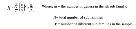
Diversity indices: Shannon’s and Simpson’s diversity indices were used to determine termite diversity within habitats. The Shannon’s diversity index (H′) is given below.
Due to technical limitations, Equation 1 has been placed in the Supplementary Files section.
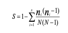
Simpson’s diversity index (S) was also used to determine the evenness of different taxa in different habitats. The evenness measure changes between 0 and 1, with maximum value when all species are equally abundant, and is independent of richness.
Due to technical limitations, Equation 2 has been placed in the Supplementary Files section.
Where, ni = the number of genera in the ith subfamily,
S = number of different subfamilies in the sample, N = total number of subfamilies,
The value of ´S´ ranges between 0 and 1; 0 represents no diversity and 1 represents infinite diversity.
Regression analysis: After conducting a multivariate correlation analysis, a multiple linear regression analysis was performed to determine the relationship between termite abundance and some quantitative and qualitative explanatory variables including weather variables (minimum and maximum temperatures, rainfall), soil type (Vertisols, Nitosols), and types of habitats.
Correspondence analysis was also carried out to determine relationships between abundance of genera in relation to the different habitats.