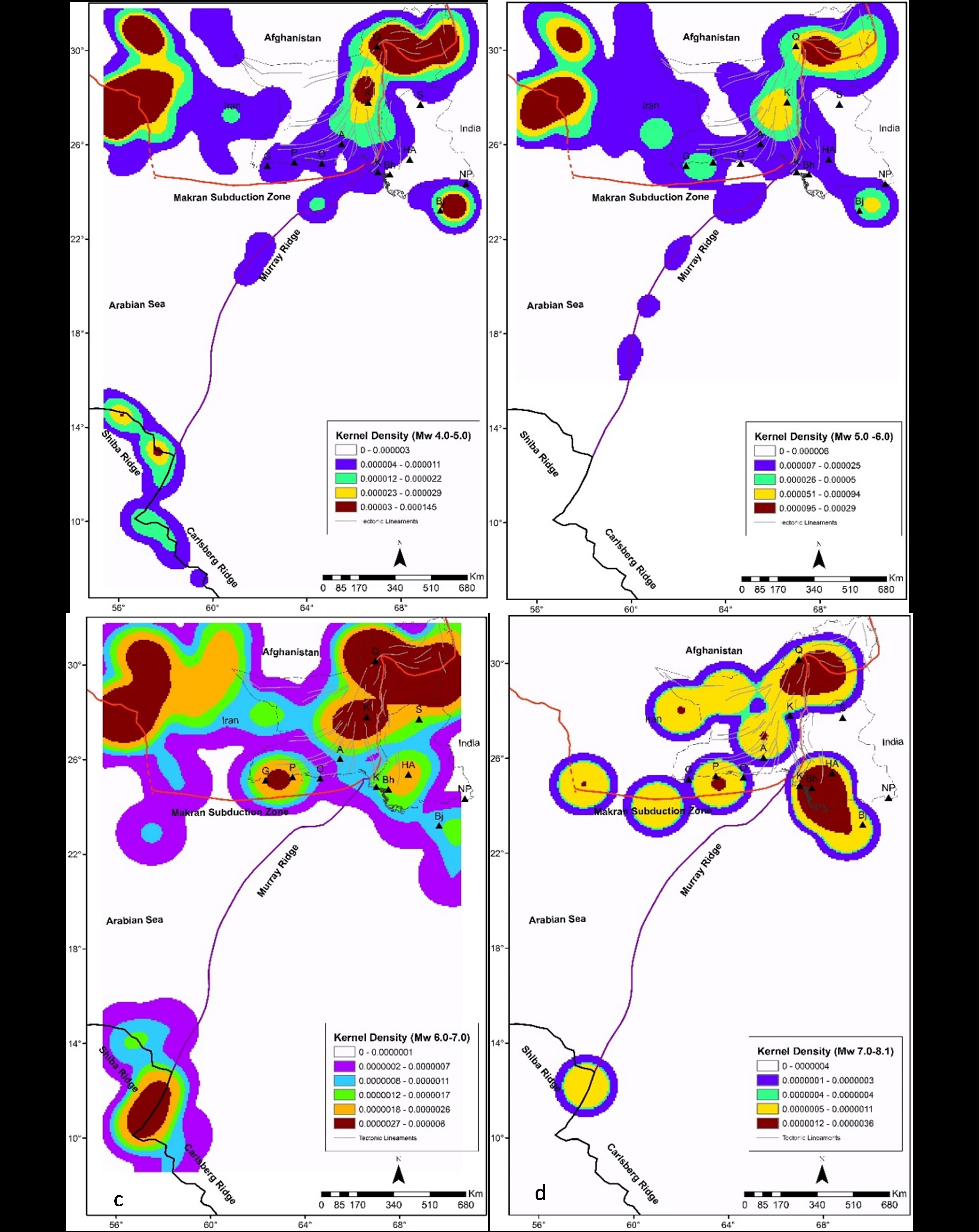
This study was aimed to expound spatial association between tectonic earthquakes and individual faults in southern Pakistan. A population of fault lines are exposed to the onshore region located to the north of active Makran subduction zone and within Indus Basin where geophysical prospecting reported neotectonic deformation and faulting. A catalog of earthquakes has been compiled considering the seismic events originated from southern Pakistan and neighboring southeastern Iran, southern Afghanistan and frontal offshore areas. Since, the faulty blocks are extending beyond the international borders, a wide region was outlined for cataloging and thorough screening of fault lines. The catalog has been thoroughly processed by standard procedures necessary for magnitude coherency, main shocks decluttering, magnitude completeness and removal of spatially outlier events etc. GIS-based vectors of fault lines were abstracted by the digitization of regional tectonic lineaments and structural maps. A rigorous effort was made to review available literature to gather updated data of plate kinematics, GPS constraints, relative blocks movement across the faults and rate of fault mechanics (slip-sense) during major events. The weights of evidence method was used to judge the spatial associations between seismic events and populations of faults lines to ascribe ‘seismicity index’ which ranked the potential faults from I (least active level) to V (highly active level). The SI helped to compare each fault response e.g. seismicity yield, released seismic stresses collinear to the fault line, active or aseismic segments and probabilistic estimate for future sizeable earthquake. Kernel density maps were prepared to allure the vulnerable pockets of the elongated faults for specific magnitude windows. The spatial patterns of earthquakes in southern Pakistan were significant to study the seismogenic potential associated with the active tectonic lineaments and faulted blocks. Spatial analysis of data sets for seismic events suggest stronger spatial associations between earthquake epicenters and faults oriented N-S, and weaker spatial associations of epicenters with some -unknown faults in the plains of Indus Basin.